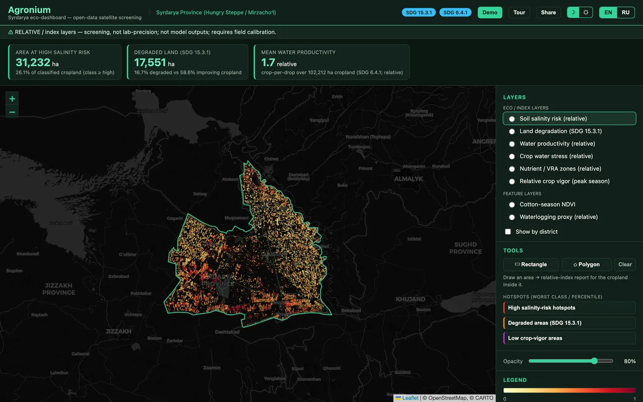
 relative index
 Soil salinity risk
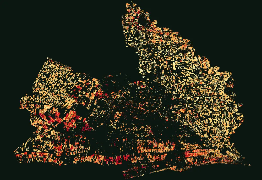
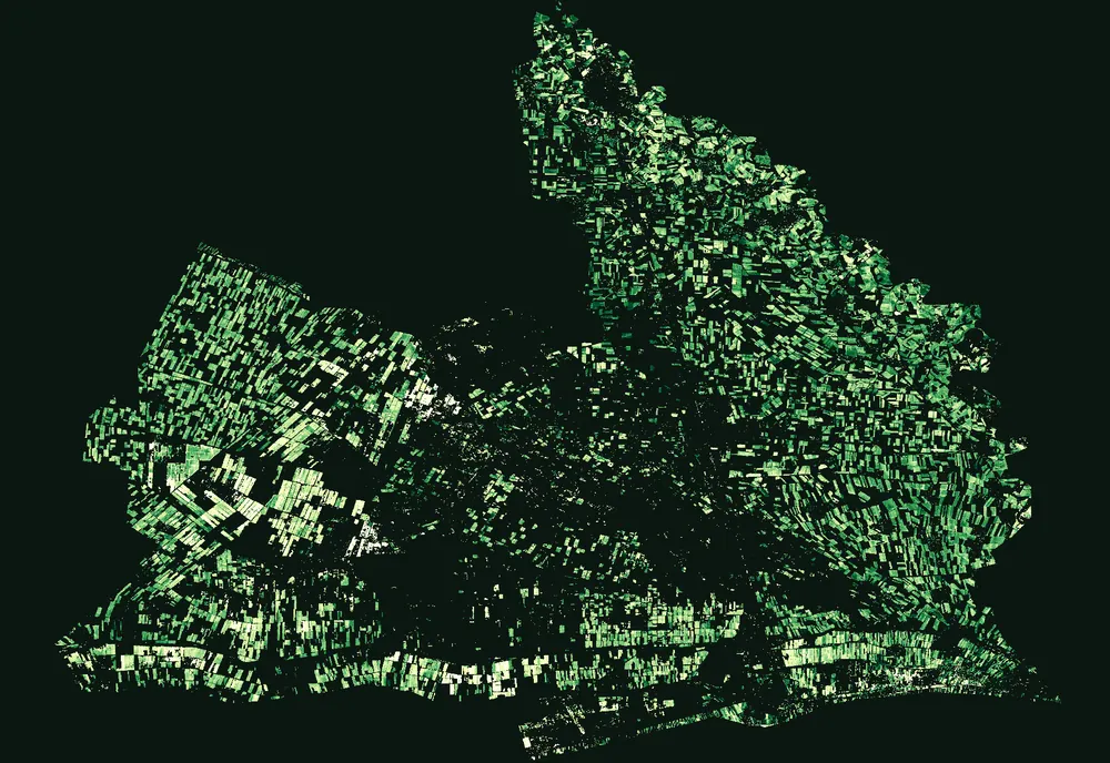
Where salt is most likely accumulating in irrigated soil — the eco-flagship layer.
Satellite + AI for sustainable land
Soil salinity, land degradation and wasted water — the unfinished legacy of the Aral. Agronium makes it visible, from open satellite data and AI.
The crisis
Central Asia's drying Aral Sea left behind salt-laden winds and over-stretched rivers. In the Hungry Steppe of Syrdarya, irrigation keeps the fields alive — but salt rises through the soil, land degrades, and water runs short. The damage is gradual, uneven, and mostly invisible from the ground.
of Uzbekistan's freshwater used by agriculture
ha of cropland at high relative salinity risk — Syrdarya satellite screening
ha flagged as degrading land — SDG 15.3.1 screening
Areas are relative-index screening figures from open satellite rasters over Syrdarya — not lab measurements.
How it works
Open imagery — Sentinel-2 (optical), Sentinel-1 (radar) and MODIS — captures every field, every season, for free.
Satellite-AI analysis turns the raw bands into clear, relative indicators of soil, water and crop condition.
Results become layers you can read by field and district — on an interactive dashboard, in your language.
What it shows
Every layer is a relative screening index from open satellite data — not a lab measurement and not a model prediction.
relative index Where salt is most likely accumulating in irrigated soil — the eco-flagship layer.
 relative index
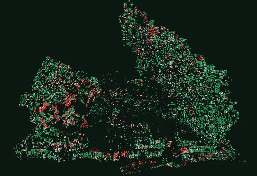
 Improving, stable or degrading land, aligned to UN SDG 15.3.1.
 relative index
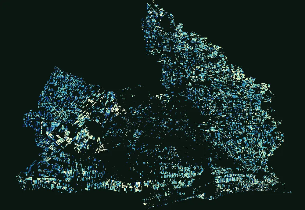
 ‘Crop per drop’ — relative biomass per unit of water. SDG 6.4.1.
 relative index
 Where crops show relative signs of water shortage during the season.
 relative index
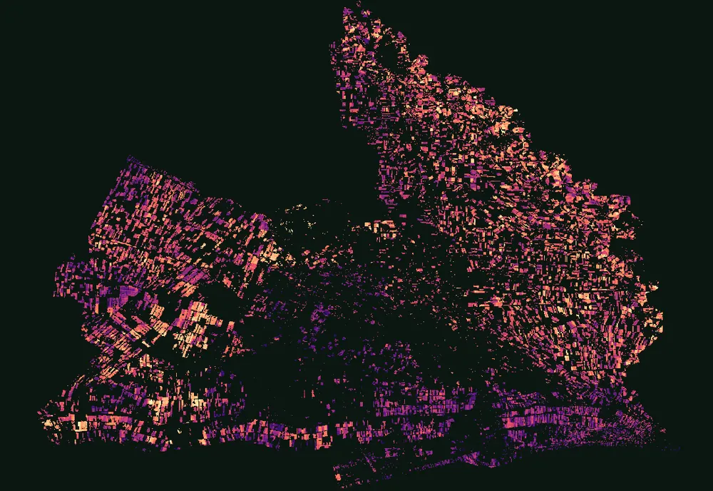
 Relative peak-season greenness — a productivity proxy, not a yield figure.
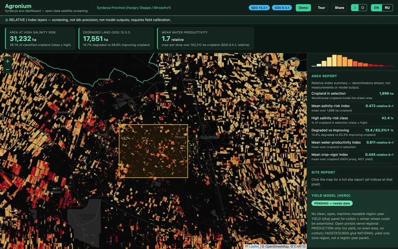
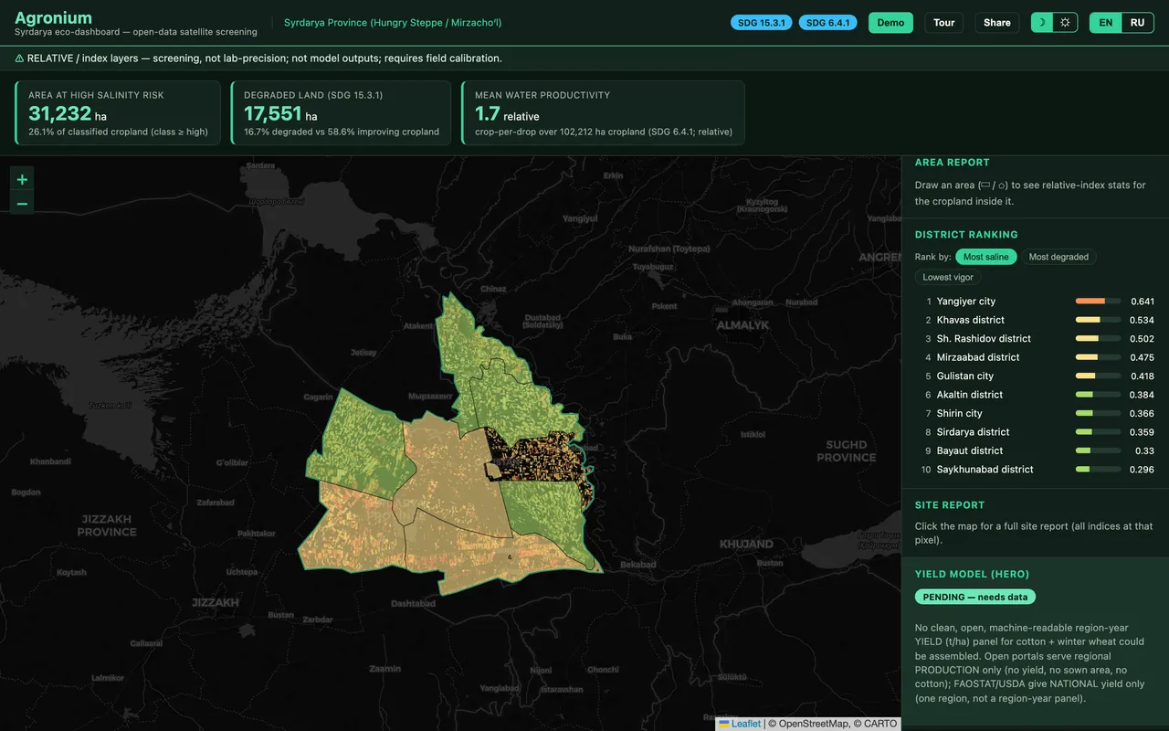
Draw any area for instant relative-index stats, rank districts, and find the worst salinity hotspots — all in your browser, on real satellite data.
Live demoWhy it matters
You can't fix what you can't see. Agronium turns open satellite data into a standing measure of land degradation and water loss — a foundation for restoring soil and saving water across a drying region.
Land Degradation Neutrality — degraded vs. improving land.
Water-use efficiency — more crop per drop.
Live demo
Draw any area for instant relative-index stats, rank districts, and find the worst salinity hotspots — all in your browser, on real satellite data.
See it live at our stand
Real screenshots of the live Agronium dashboard — fully interactive at our stand.
Built to be trusted
Agronium runs entirely on open satellite data and the satellite-ML platform Morfo Labs already proved with Mineralium. It is a working prototype: satellite screening with relative indicators, not lab measurement — and it does not claim a trained per-field yield model.
Who we are
A Tashkent-based AI lab and resident of IT Park Uzbekistan, building satellite and machine-learning platforms for the region's natural resources — minerals (Mineralium), water (Aquanium) and now sustainable agriculture (Agronium).
morfolabs.uz ↗